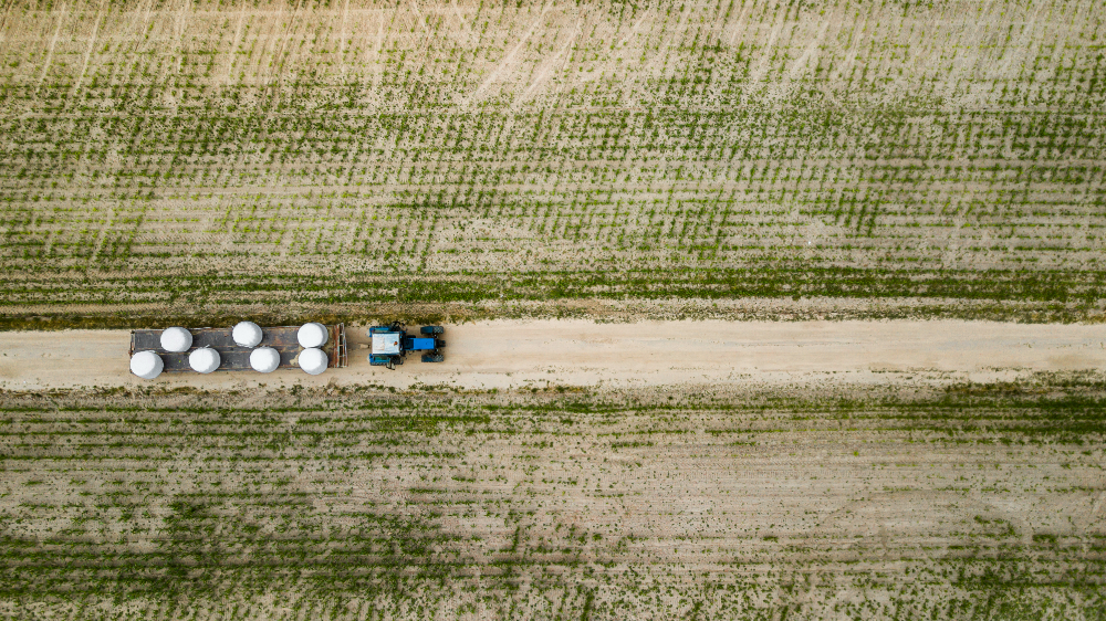
Satellite-Powered Solutions for Agriculture Supply Chain
The agricultural supply chain represents a huge web of connected processes, from the soil in which crops take root to the tables where food is served. It connects farmers, suppliers, and logistics providers with consumers on every continent, each step in the chain bearing the responsibility of productivity, efficiency, and sustainability. This system, however, is highly susceptible to disruption: climate unpredictability, market fluctuations, and logistical bottlenecks can cause ripples down the chain that amount to waste and economic strain.
Today, technology is writing new rules. Satellites, once sent into space for space exploration, now orbit the Earth for a different reason: to solve ground challenges. By providing real-time insights, predictive analytics, and precise monitoring, satellite data is increasingly becoming an essential weapon in the armory aimed at hardening agricultural supply chains. From optimizing harvest timing to enhancing logistics and reducing food waste, satellite-powered solutions promise to make this intricate system more resilient, efficient, and sustainable.
Supply Chain in Agriculture
The agricultural supply chain is one big, living network, from the seed to the consumer, along every stage of production of food. It begins on the field, where knowledge, resources, and increasingly, technology, are needed for farming. Today, such tools as free high-resolution satellite imagery offer farmers new insights into their land to optimize planting schedules, monitor crop health, and use resources more effectively. It’s the first important step in a journey of food to the world.
It comes down to harvesting, storing, and transporting the produce in its due time. Missing timing means spoiled, wasted produce, or lost profits. Movements have to be precise, right from field warehouses, to ensure the freshness of the produce as it changes hands at various processors, manufacturers, and logistics providers. For farmers and suppliers, that means balancing speed with sustainability: racing against the clock while trying to minimize one’s environmental footprint.
Finally, the agricultural supply chain reaches its destination: markets, grocery stores, and tables across the globe. Here, the culmination of countless efforts becomes visible, but the work never truly ends. Demand keeps evolving, climate change adds complexity, and unforeseen disruptions challenge even the most well-organized systems.
By integrating technologies like satellite-powered data, agriculture can bridge gaps in this intricate chain. Enhanced visibility and smarter decision-making ensure that food moves more efficiently, waste is reduced, and resources are preserved, bringing much-needed balance to a system that feeds billions.
Agricultural Supply Chain with Satellite Images
Satellite imagery has become an invaluable asset in modern agriculture, offering unparalleled visibility and insights that drive smarter decision-making. With the ability to monitor vast fields and track changes in crop health, soil conditions, and weather patterns, satellites are transforming the way farmers and agribusinesses operate. Technologies like high-resolution multispectral satellite imagery allow for precise analysis of vegetation health, irrigation needs, and nutrient distribution, helping farmers optimize their resources while minimizing waste.
Satellite imagery increases the efficiency of every stage in the agricultural supply chain. It shows real-time data on planting conditions to predict the time when crops will be ready for harvest, thus eliminating delays and enhancing productivity. Tools that offer ultra high-resolution satellite imagery are particularly crucial for logistics, as they enable more accurate planning of transportation routes and storage management. By identifying potential bottlenecks and risks, these advanced images ensure that crops move swiftly and sustainably through the supply chain, reducing losses and enhancing food security.
As agriculture continues to face the pressure of meeting global demand in a sustainable manner, satellite-powered solutions are equipping stakeholders with clarity and control to streamline operations and build resilience.
Other Useful Applications of Satellite Data in Agriculture
From pre-planting through post-harvest, the ability to monitor fields with high-res satellite images offers farmers the tools they need to make data-driven decisions and address challenges proactively.
Crop Monitoring and Health Assessment
Satellites can provide frequent and detailed views of farmland, enabling farmers to detect early signs of crop stress, disease, or pest infestation. Using very high resolution satellite imagery, subtle changes in plant health can be identified, helping farmers take timely corrective actions to prevent yield losses.
Soil and Field Analysis
Satellite data allows for the assessment of soil moisture levels, nutrient distribution, and field conditions. By analyzing patterns with high precision, farmers can optimize irrigation schedules, fertilizer application, and crop rotation strategies to improve efficiency while conserving resources.
Weather Forecasting and Risk Management
Accurate weather monitoring backed up with relevant satellite data helps predict climate patterns, floods, and drought risks. This information is critical for planning planting, harvesting, and mitigating the impact of extreme weather events, which can disrupt the agricultural supply chain.
Yield Prediction and Harvest Planning
Satellite imagery supports yield estimation by analyzing crop development over time. This allows farmers and suppliers to better prepare for harvesting, storage, and logistics, ensuring produce reaches markets on time while minimizing waste.
Supply Chain Optimization
Satellite data plays a vital role in streamlining the agricultural supply chain. With real-time monitoring and high-resolution insights, farmers and distributors can plan efficient transportation routes, monitor storage conditions, and identify potential disruptions, reducing delays and losses.
By leveraging advanced satellite technologies, agriculture is becoming smarter and more resilient. From enhancing field management to ensuring smooth supply chain operations, satellite-powered insights are helping farmers adapt to modern challenges and meet the growing demand for food with greater precision and sustainability.


